Oriented Bounding Box Annotation

Precision annotation for rotated objects

Professional oriented bounding box labeling for aerial imagery, text detection, and rotated object recognition. Capture any orientation with pixel-perfect accuracy for advanced computer vision applications.
TRUSTED BY
DJI
Maxar
Planet Labs
Airbus
Esri
DigitalGlobe

Annotation Capabilities

Comprehensive rotated object annotation

Advanced oriented bounding box annotation for complex scenarios where standard boxes fall short

Aerial & Satellite Imagery

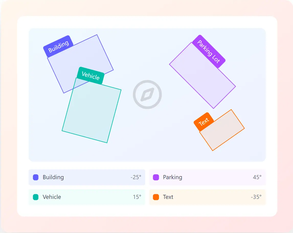
Annotate buildings, vehicles, and infrastructure from overhead perspectives with precise rotation angles.

Text Detection & OCR

Capture text at any angle for robust OCR systems and document analysis applications.

Maritime & Port Monitoring

Track vessels, containers, and port infrastructure with orientation-aware annotations.

Precision Agriculture

Annotate crop rows, field boundaries, and agricultural equipment at any orientation.

Parking & Traffic Analysis

Detect parking spaces and vehicles at various angles for smart parking and traffic management.

Object Detection at Scale

Train robust object detectors that handle rotated instances across diverse viewing angles.

Our Process

How oriented bounding box annotation works

A precise workflow that captures rotation angles and dimensions with perfect accuracy

STEP 1

Upload Imagery

Upload aerial, satellite, or ground-level images requiring rotation annotation

STEP 2

Define Parameters

Specify object classes, angle precision, and annotation guidelines

STEP 3

Precision Annotation

Expert annotators draw oriented boxes with accurate rotation angles

STEP 4

Angle Verification

Quality assurance team verifies rotation accuracy and box alignment

Precision annotation at any angle

Trusted by leading geospatial and computer vision companies worldwide

25M+

Oriented boxes annotated

0.1°

Angle precision

99.8%

Rotation accuracy

360°

Full rotation coverage

Use Cases

Oriented annotation across industries

Powering rotation-aware computer vision in diverse applications

Autonomous Vehicles

Rotated vehicle & sign detection

Geospatial Intelligence

Satellite imagery analysis

Real Estate

Aerial property assessment

Document Analysis

Text at any angle detection

Aerial Inspection

Drone-based monitoring

Agriculture

Crop row & field analysis

Maritime Logistics

Port & vessel monitoring

Object Detection

Rotation-invariant training

Ready to annotate rotated objects?

Get precise oriented bounding box annotations for your aerial imagery, text detection, and object recognition projects.

Oriented Bounding Box FAQs

Common questions about our rotated object annotation services

An oriented bounding box (OBB) is a rectangular annotation that can be rotated to any angle, unlike standard axis-aligned bounding boxes. OBBs provide a tighter fit for rotated objects, reducing background noise and improving model accuracy for aerial imagery, text detection, and objects at various orientations.

We achieve angle precision to within 0.1 degrees through our specialized annotation tools and trained experts. Each oriented box includes width, height, center coordinates, and rotation angle, all verified through our multi-layer QA process for 99.8% accuracy.

Oriented bounding boxes excel with aerial and satellite imagery, drone footage, scene text images, parking lot overhead views, and any scenario where objects appear at various rotation angles. They are particularly effective for buildings, vehicles, ships, text, and agricultural features in overhead imagery.

We export oriented bounding box annotations in DOTA format, COCO with rotation extensions, custom JSON with center-width-height-angle parameters, and framework-specific formats for rotated object detection models. All exports include rotation angle in degrees or radians as needed.

Oriented bounding box annotation is typically 30-50% more expensive than standard boxes due to the additional complexity of determining optimal rotation angles. However, the improved accuracy and tighter object fit often result in better model performance, making it cost-effective for applications requiring rotation invariance.

Yes, we regularly process millions of aerial and satellite images with oriented bounding box annotations. Our largest geospatial project involved annotating 15 million building footprints from satellite imagery for urban planning applications. We have specialized workflows for high-resolution aerial imagery and can handle massive datasets efficiently.